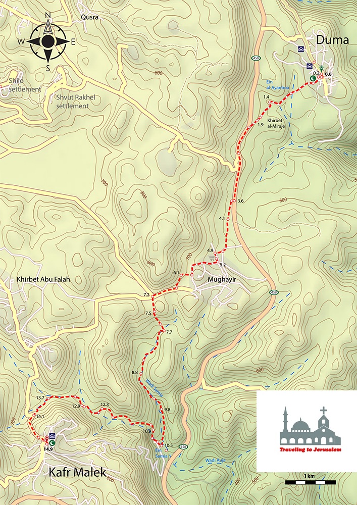


You start this hike from Duma which is 25 kilometers southeast of Nablus, by walking through a landscape of olive groves, wheat fields, and limestone villages in the beautiful hills of the Nablus region from the picturesque village of Duma. Besides the few small sections on paved road, this segment takes you alongside a rocky valley. You complete this stage by reaching up a steep ascent that ends up at Kafr Malek village, where warm hospitality and welcoming awaits you.
Kafr Malek, which is 17 kilometers northeast of Ramallah, and surrounded by the villages of Almughayyer, Kherbet Abu Falah, Almazra’a Alsharqiyya (Eastern Farm) and Dair Jreer (Jreer Monastery), is a very famous village for growing olive and fruit trees such as almonds and grapes. It is also well known for growing cereals and different types of vegetables, especially onion which is very popular in that area. The residents depend on the rainwater in irrigating their crops and in drinking.
Many archeological ruins, historical remains and shrines are located in Kafr Malek. The most important of these ruins is Kherbet (ruin) Ain Samya which goes back to the Bronze Age.
Info:
Walking Distance: Approximately 14.9 km
Walking Time: Approximately 5 hours
Difficulty: Moderate to Difficult
Recommendations:
Accommodations in Kufur Malek: